Product update
Mapsake 1.9: Your Photos Light Up the World
Maplight turns years of travel photos into illuminated land, while a new History view and 40 achievements give your personal atlas more ways to surprise you.
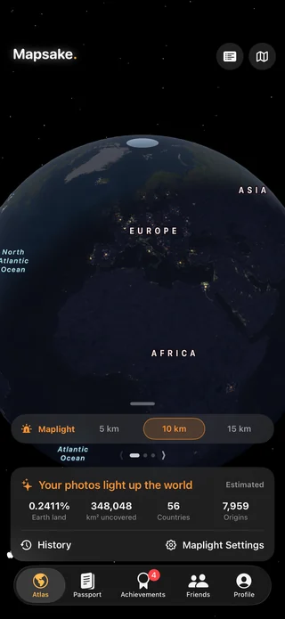
A new way to see everywhere your photos have reached
Mapsake 1.9 introduces Maplight, a playful new view that turns the locations behind your travel photos into light on the map. Open Maplight and the places represented in your library begin to glow. A weekend close to home may create a tight pool of light. A road trip can trace a chain across a region. Years of flights, walks, ferries, and family visits can become a pattern that is unmistakably yours.
The idea is simple: a country map says which places you have visited, while Maplight shows the smaller pieces of the world your own photos actually touch. It is less like checking destinations off a list and more like revealing a personal constellation.
Maplight works with the travel evidence already in Mapsake. Located Apple Photos, supported imports, passport stamps, and places you add can contribute to the result. You choose a light radius, and Mapsake calculates the illuminated land around those generalized points.
Watch your history appear year by year
Maplight includes a History view for people who want more than one finished picture. Move through the years and watch the illuminated area grow as new trips enter the record. A familiar city may appear first, then a neighboring state, then a line of destinations across an ocean.
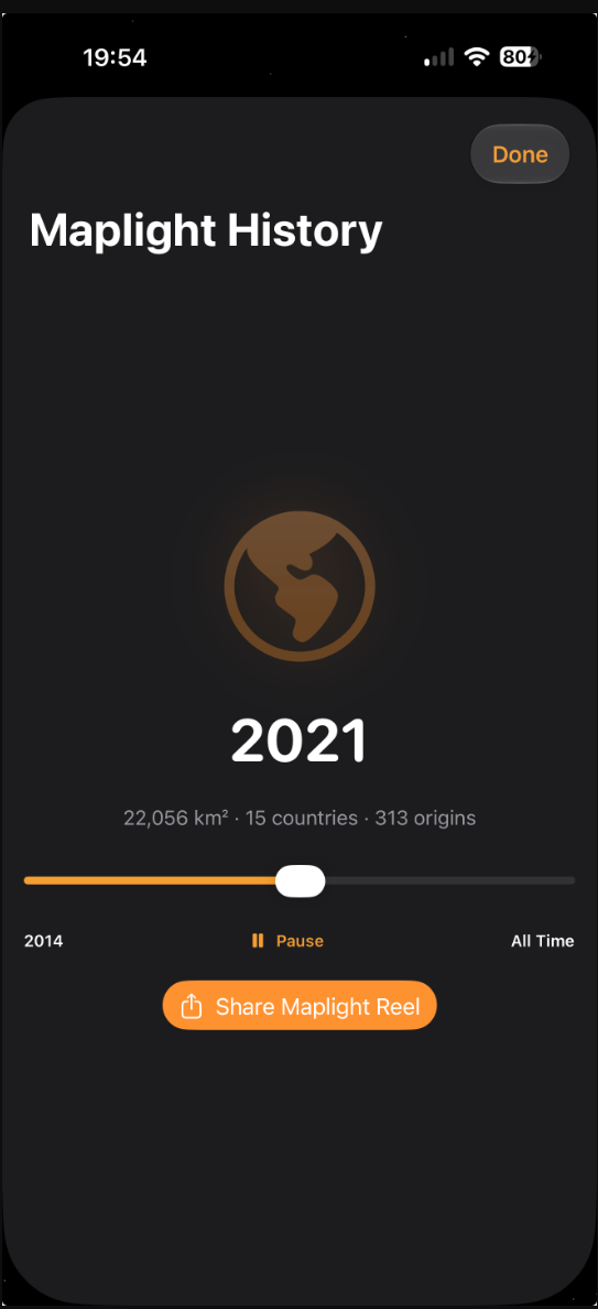
That timeline can reveal chapters that a lifetime total hides:
- the first year you traveled on your own;
- a period when weekends were mostly close to home;
- a move that changed the center of your map;
- a long trip that suddenly connected several countries;
- the years when family, work, or curiosity kept drawing you back to one region.
Photos without a reliable date can still contribute to the overall map, but a dated source is what lets Mapsake place that light in the correct year. If something looks wrong, the original place and photo controls remain available so you can correct the underlying record.
Choose how far each memory shines
Maplight offers several radii because there is no universal definition of the area around a visit. A small radius emphasizes the streets and landscapes close to each source. A wider radius creates a broader picture of the territory surrounding your travels.
The setting is not intended to claim that you explored every road inside a circle. It is a visual measure: given the locations represented in your atlas, how much nearby land do those moments illuminate? Water is excluded from the land total, overlapping light is counted once, and country boundaries are respected when Mapsake prepares the coverage summary.
Try more than one radius. The close setting is especially satisfying for dense photo libraries and city travel. A wider setting works well for a high-level lifetime view or for sources that represent a destination without exact photo coordinates.
Coverage totals without turning travel into a contest
The Maplight summary estimates illuminated land and shows a country breakdown. It can answer questions such as which country contains the most of your photo-covered area, or whether a year of local exploring added more light than a long-haul vacation.
The number is designed for reflection, not competition. Someone who photographs daily in one region may light more fine-grained area than someone who records only a few landmarks on a long trip. Neither history is more legitimate. The interesting part is how faithfully the map reflects the way you choose to remember.
Mapsake keeps the source breakdown visible so the result is understandable. If a location came from a photo, an imported trip, a passport stamp, or a manual place, that origin remains part of the explanation rather than disappearing into a mystery score.
Forty new achievements to discover
Version 1.9 also expands Achievements with 40 new milestones. They range across the atlas, photo history, exploration, and the new Maplight experience. Some recognize broad progress. Others reward unusual paths, patient collecting, or returning to features you may not have explored recently.
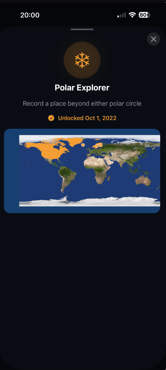
Achievements are calculated from your Mapsake record. They are not a demand to travel farther, spend more, or collect places for their own sake. The best ones arrive as a pleasant surprise: you open the wall after updating your history and discover that something you already did now has a name.
The achievement detail view explains why a milestone unlocked and shows the evidence behind it when appropriate. Search and filtering make a growing collection easier to browse, while locked achievements leave room for discovery without exposing every surprise at once.
Private by default, including Maplight
Maplight is built from location evidence, so privacy was part of the feature from its first data model. Before Maplight data is stored, photo coordinates are reduced to generalized geographic cells. The app does not need to put your original photo files into its sync record, and the website never receives your private Maplight history just because you use the feature.
Your Mapsake data can sync through your private iCloud account when that service is available. Public sharing remains a separate, deliberate choice. If you enable Maplight on a public map, the shared result is a generalized illumination snapshot rather than a copy of your photo library or a list of exact source coordinates.
You can also export your Mapsake backup, including the portable Maplight history, or remove Maplight data through the app's data controls.
Small improvements throughout the app
The 1.9 update includes refinements around the new features and the rest of the atlas: clearer progress states while Maplight prepares coverage, more useful achievement details, better handling of overlapping and border-adjacent light, and reliability work for histories that sync across more than one Apple device.
The result should feel less like a separate analytics screen and more like another lens on the same personal atlas. Places, photos, dates, imports, Passport, and achievements now have one more way to connect.
Start with the map you already have
There is no special setup project required. Update Mapsake, open Maplight from the Atlas, and let the app use the history already recorded on your device. If the map is sparse, that can be useful too: add a missing trip manually, review photos without locations, or import a supported travel history, then return to see the light change.
Mapsake 1.9 is available as a free update for iPhone, iPad, and Mac, with the shared Mapsake experience continuing across Apple Watch and Apple TV. Your next trip can add a new patch of light, but the best first view may be the one built from all the ordinary places you had almost forgotten.